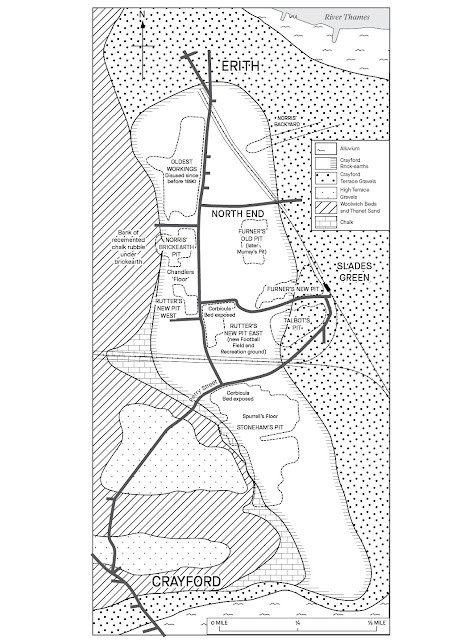
In 1944 Alfred Kennard published, in the Proceedings of the Geologists Association, a sketch map of the Crayford Brickearths region. There is growing interest in the UK loess so it seems like a good idea to publish a slightly updated version of the Kennard map. The revisions were done by Kerry Allen at the University of Leicester Cartographic Unit; a discussion of the new map will be published in British Brick Society Information.

No comments:
Post a Comment